We made it! We're in Bisbee watching the sun melt away last night's snowfall. We drove all this way and it feels just like home with these temperatures. Granted we're at 6000 feet, so that helps.

I'm going to have to dig deep to remember all the things we did since I last wrote all the way back in Austin. Let's see. . . we left Austin in our cupcake coma to go to Enchanted Rock which has been on our list to climb forever. I really liked the park, but you could say I was less than enchanted with the climbing. Some days, I just don't feel like climbing and that happened to be one of them. We did manage to do one pitch, but then opted for a nice hike up Enchanted Rock instead.
San Antonio was next on the agenda where we visited the Alamo and the four missions. We realized afterward that we probably should have stopped to see a bit more of the town, but were so put off by the area around the Alamo and driving the Mission Trail itself that we were ready to move on. Mission San Jose was definitely the best of the four, both for how much of it had been preserved or restored, but also in how much we could access. NPS is doing some work on the missions that blocked off some big areas and really all of Mission San Juan. We were most surprised by the fact that all four still held church services and Mission Espada still had friars living there.
Front of the Alamo. Impossible to not include people in the photo.
Alamo Barracks
Homes along the outer wall of San Jose
We camped out on Lake Calaveras just outside of town that night. Other than the ridiculous amount of birds, the most notable thing about that campground was the fact that the bathroom stall walls only came up to my chin, which would have made for a rather friendly bathroom atmosphere if anyone else had come in while I was there. Maybe I should have taken a photo of that too just for fun.
We made our way to Amistad National Recreation Area just outside of Del Rio. We camped out there as a stopover on our way to Big Bend and unwillingly left behind warm weather, cell phone coverage, and data coverage for the rest of our trip here. Not that I'm complaining. About the weather at least. Phone is another issue.
We had a long drive to Big Bend through a whole lot of wide open ranchland, stopping to check out the Pecos River as it meets up with the Rio Grande on the border. We drove all the way down through Big Bend to the campground right on the river where we were pleasantly surprised with a hot springs just a few paces away from the Mexico border. Not a bad way to spend my 30th birthday.
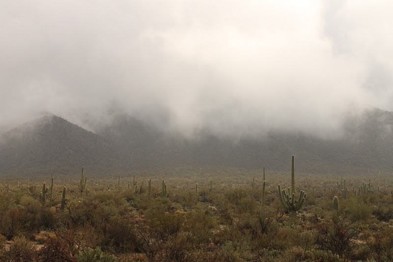
On Monday, we hiked in the Chisos Mountains up Emory Peak (the highest in the park). We're still used to Katahdin where when a mountain's elevation is 7000+ feet, you expect to hike all 7000 feet of that, but then we remembered we were already starting out at 5000 feet or so and we cruised that mountain. The trail ended rather abruptly quite a ways below the peak, so we scrambled up to get a better view.
Casa Grande
Mexican Jay. If you think seagulls are bad, you should meet this guy
View from the top
The temperature dropped pretty significantly that night while we camped out in the middle of the park, but thankfully we'd planned a driving tour for our last day in the park. We drove all over the western half and stopped at a few places to hike. The first was at Burro Mesa Pouroff where a river wash starts from the rain water off the mountain:
This gives you a better idea of the scale of it
We also hiked along the Rio Grande at the Santa Elena Canyon. A beautiful spot and the trail wound along the river through huge boulders smoothed by the river waters.
We left Big Bend the next morning without a wildlife sighting to report, other than that pushy Mexican Jay. No mountain lions, no bears, no javelinas, and of course no snakes or scorpions in this cold. We headed due north for Guadalupe Mountains National Park and finally did see a few javelinas alongside the road. At someone's recommendation, we went through this little town called Marfa. I guess it's well know for it's art community and all of these great places to eat. Can someone please tell me where these things are? It was like a ghost town. We actually wanted to stop and eat lunch there (you can only eat so many PB&J sandwiches before you need a break) but we couldn't find anyplace open! No restaurants, no shops, nothing. I don't know what all the fuss is about.
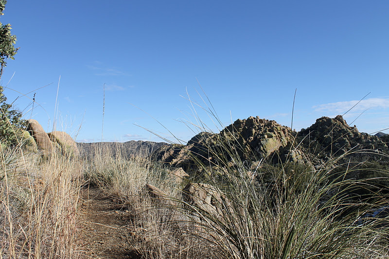
Anyway, as we headed up into the Guadalupes, we finally got to see some snow! Which of course means that I got pelted by a snowball as soon as there was enough snow for Curtis to grab. We had planned on hiking Guadalupe Peak (highest in Texas) but some serious winds ruined my motivation. Instead, we did just about every other hike possible in the park. We did about 12 miles on multiple trails through Devil's Hall and along the foothills over to an old ranch and into some beautiful springs that you would never expect to find surrounded by desert.
El Capitan (of Texas)
Hiker's staircase on Devil's Hall trail
Hiking the Frijole trail
Looking back at El Capitan and Guadalupe Peaks
Manzanita Springs
We moved on a day early to explore Carlsbad Caverns, about an hour north of Guadalupe in the same mountains. They were great! And no King Tut's disease to speak of, which says wonders about how much nicer these caverns were than Mammoth Caves. Cleaner, prettier, no graffiti, and we didn't need to go on a guided tour to see the caves. We got to wander on our own, at our own pace.
One of the drip pools
Whale's Mouth
Cave Man
We drove into Carlsbad expecting. . . well, something more than there was. Not much to the town so we headed out to Sitting Bull Falls in hopes of some hiking. After driving 30 miles down a road that leads only to that place, we came across a sign saying the area was closed until further notice. It might have been nice to put that sign about 30 miles back on the main road, but oh well. We stayed nearby at Brantley Lake State Park which is now the recipient for my Worst Shower Award at any public campground I have visited. And I've had some bad ones on this trip, so that honor is well earned.
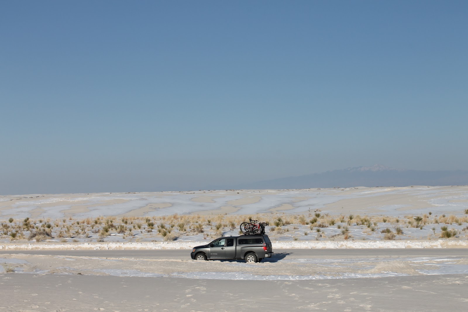
We visited White Sands National Monument the next day with the gypsum sand dunes glittering in frost and snow. We didn't join in the sledding fun, but walked all around and slid down on our feet instead.
Our drive that day had taken us through the Lincoln National Forest, climbing into the mountains with snow all around. We even passed through a cute little ski town by a tiny little ski mountain. It helped make it feel more like Christmas than when we'd been surrounded by desert.
We reached our 10,000 mile mark the next day as we drove over to Truth & Consequences, NM (known for its hot springs) and stopped into Hatch too so Curtis could try out one of the famous green chile cheeseburgers. We camped in the Gila National Forest for our last (cold) night out for awhile. We saw elk prints at our site, but never saw any.
On our way to Bisbee, we wound through the mountains and stopped by Silver City to explore the historic downtown. Then finally we made it to Frank and Etta's house here in Bisbee and are settled in for the holidays. I even got to decorate their Christmas tree yesterday morning before we headed downtown to see the sights. There's a lot to explore in the area and all over Arizona so we're plotting our next move while enjoying our warm, cozy place to stay with family.
So that's all for now. I suppose I should get a photo of us here at the house, so I'll do that at some point. This should hold you all over for awhile :)